Langshan is located in Langshan Town, Xinning County, Shaoyang City, Hunan Province, in southwestern Hunan. Its geographical coordinates are between 110°28′53″ and 110°18′34″ east longitude and between 26°13′06″ and 26°55′21″ north latitude. It borders Guilin to the south and faces Zhangjiajie to the north, with a total area of 108 square kilometers.
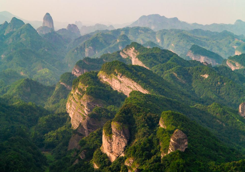
Langshan is situated in the low mountain, hilly, and river valley area of the Nanling Mountain System in China, in the transitional zone between China's third-level and second-level terrain. The terrain is high in the south and low in the north. The main peak of Bajiaozhai, at an elevation of 818 meters, is the highest peak in Langshan. The landform types are diverse, with mature-stage danxia peak clusters and peak forests as the typical feature. Langshan has a mid-subtropical humid monsoon climate, with an average annual temperature of 15.5°C and an average annual rainfall of 1,450 mm. The Fuyi River runs through the entire area from south to north.
Langshan is a large danxia landform scenic area rarely seen in China and even in the world. It is part of the World Natural Heritage "China Danxia" and the Nanshan National Park of Hunan Province. It is home to the Hunan Langshan National Geopark and the Shaoyang City Langshan Scenic Area, and features attractions such as Bajiaozhai, Chili Peak, Tianyi Lane, Fuyi River, Zixia Cave, and the Natural Bridge. In March 2024, the China Overseas Chinese International Cultural Exchange Base was established in Langshan.