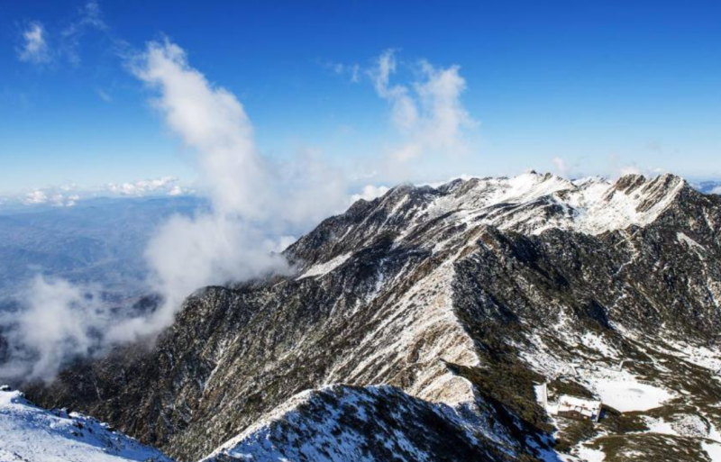
Cangshan Mountain, also known as Diancang Mountain, has been referred to in ancient texts as Diancang, Xiongcang, or Dali Mountain. It belongs to the Yunling range of the Hengduan Mountains, which is the southern extension of the Himalayan orogenic belt. Located in central Dali Bai Autonomous Prefecture, Yunnan Province, west of Erhai Lake (between 100°55′00″–100°11′30″ E and 25°34′30″–26°00′00″ N), it serves as the boundary mountain between Dali City and Yangbi Yi Autonomous County. The mountain range runs from northwest to southeast, starting from the Guanglanba Pass west of Huadianba in the north and extending to the Xi'er River in the south. It is approximately 48 kilometers long and 18 kilometers wide from east to west. The Cangshan range consists of 19 peaks aligned in a row from north to south, with altitudes ranging from 3,074 to 4,122 meters. The highest peak, Malong Peak, reaches an elevation of 4,122 meters, creating a relative height difference of about 2,500 meters from the valley on the western slope and about 2,100 meters from Erhai Lake on the eastern slope.
Cangshan is a fault-block mountain characterized by rising terrain, numerous cliffs, and overlapping waterfall groups. Quaternary glacial landforms and glacial deposits are well-developed here. Horns and arêtes can be found at altitudes above 3,800 meters, while cirques and cirque lakes are distributed between 3,300 and 3,800 meters. Glacial erosion lakes and their deposits are located at altitudes of 2,900 to 3,300 meters, with glacial valleys situated below these lakes—the famous "Eighteen Streams of Cangshan" are all such glacial valleys. Moraine gravel layers and fluvioglacial gravel layers are distributed in the foothills of the mountain.
Administratively, Cangshan spans across Dali City, Yangbi Yi Autonomous County, and Eryuan County. It is an important water source for Erhai Lake and is designated as a National Geopark. It is also a vital component of the Cangshan-Erhai National Nature Reserve, the Dali National Scenic Area, and the Dali Cangshan Global Geopark. As one of the earliest developed regions by humans, it is the namesake for "Marble" (Dali Rock) and the "Dali Glaciation." It is also one of the most biodiverse regions in northwestern Yunnan Province.
On April 10, 2026, the results of the "Cangshan Comprehensive Scientific Expedition" were officially released in Dali. The three-year expedition involved over 4,000 person-visits and discovered more than 1,000 newly recorded species.