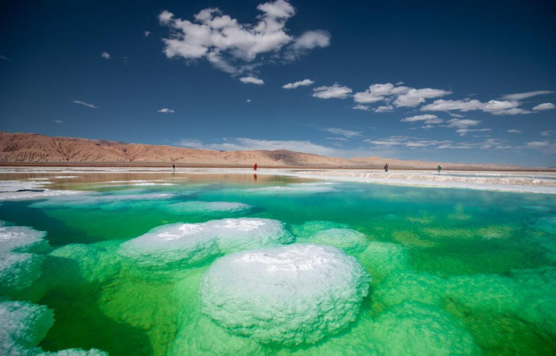
Mangya Emerald Lake lies on the eastern edge of Gasi Lake in Mangya City, Haixi Prefecture, Qinghai Province, southwest of Huatugou Town. It is 2 kilometers south of National Highway 315 and the Golmud-Korla Railway, and about 23 kilometers from Huatugou Town.
As a magnesium sulfate subtype salt lake, it has an average depth of 0.5 meters and covers an area of around 26 square kilometers. The lake bed features a halite layer generally 5 meters thick, with a maximum thickness of 9.68 meters. Nestled between the Kunlun Mountains and the Altun Mountains at an altitude of roughly 3,200 meters on the western rim of the Qaidam Basin, the site was once a potash mining area. It was transformed into an artificial salt lake landscape through ecological restoration after 2021. Rich in minerals including potassium, magnesium and lithium, the lake water displays varying shades of emerald green. Its signature sights include central salt bridges formed by white salt crystals and a matrix of geometric emerald salt ponds. Red Hero Mountain and Yadan landform clusters spread along the lake perimeter, creating a striking visual contrast of red, white and green. On clear days, the snow-capped peaks of the Kunlun and Altun Mountains are mirrored on the water surface.
Mangya Emerald Lake officially opened to visitors on May 1, 2021. It has since become a popular stop on self-driving routes linking Qinghai and Xinjiang. Offering diverse experiences such as salt flat sightseeing and geological popular science, it serves as a key tourist hub on premium Qaidam travel itineraries for trips crossing between Qinghai and Xinjiang. The scenic area is open daily from 08:00 to 20:00.