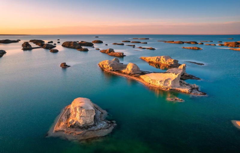
Also known as the Water Yadan, Wusute Yadan Geopark sits in the hinterland of the Qaidam Basin, at Xitai No.2, Da Qaidam Administrative Committee, Haixi Mongolian and Tibetan Autonomous Prefecture, Qinghai Province (at the 900-kilometer mark of National Highway G315). It borders Qinghai Lake and Chaka Salt Lake to the east, is 300 kilometers away from Golmud City to the south, 350 kilometers from Mangya Town to the west, and 500 kilometers from Dunhuang to the north, covering an area of approximately 21,000 square kilometers.
Nestled within the Nanbaxian Yadan Group, Wusute Yadan features Yadan mounds ranging from 10 to 25 meters in height, with the tallest reaching 50 meters. It has a plateau continental climate. On October 22, 2015, the development project for the Da Qaidam Wusute (Water) Yadan Scenic Area was officially approved. Construction broke ground in July 2016. The scenic area entered trial operation on April 29, 2018, and the Wusute (Water) Yadan Geopark officially opened on June 23 the same year. The geopark consists of Yadan landforms and the surface of Yahu Lake. Its lake water originates from the Nalinggele River Valley in the western Kunlun Mountains. Over millions of years, environmental changes, water erosion and wind abrasion have shaped the Yadan group at the junction of the northern and western hilly natural zones of the Qaidam Basin, forming the one-of-a-kind Wusute (Water) Yadan landform cluster.
On June 11, 2021, Wusute Yadan Geopark was rated a national AAAA-level tourist attraction. On May 8, 2017, the Wusute Yadan Geopark (Water Yadan) Scenic Area Project was included in the *2017 National Preferred Tourism Project Catalogue* by the National Tourism Development Commission. In February 2024, Wusute Yadan Geopark was recognized as one of the first batch of provincial eco-tourism scenic areas in Qinghai Province.