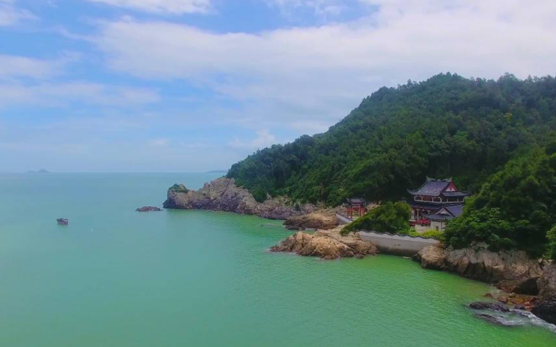
Dandong Dalu Island Scenic Area is located in the Yellow Sea, approximately 12.96 kilometers south of the estuary of the Dayanghe River in Dagushan Town, Donggang City, Dandong City, Liaoning Province. It is bordered by Donggang to the north, Dalian to the west, the Changshan Islands to the southwest, and faces the Korean Peninsula across the sea to the east. The island stretches 4 kilometers from east to west and 1.5 kilometers from north to south, with a coastline of 12.15 kilometers and an area of 6.6 square kilometers.
The terrain of Dandong Dalu Island Scenic Area is dominated by hills with a small amount of plain. Its geological structure is stable and mainly composed of rock. The island features distinct hydrological characteristics, with clear surrounding waters and pronounced tidal phenomena. The climate is a north temperate sub-humid monsoon climate. The vegetation coverage rate is high, mainly consisting of temperate tree species such as pines and locust trees. The area is rich in biological resources, with a wide variety of common birds and marine life. The scenic area is well laid out and features multiple viewing spots, such as Moon Bay and Wanghai Tower.
Dandong Dalu Island Scenic Area has won more than 20 honors, including National AAAA-Level Tourist Attraction, National Key Village for Rural Tourism, China's Beautiful and Leisurely Countryside, Provincial-Level Characteristic Village for Leisure Agriculture and Rural Tourism, Provincial-Level Patriotic Education Base, and National Defense Education Base. On August 24, 2022, Dandong Dalu Island Scenic Area was selected for the public announcement list of Liaoning Province's 2022 "Provincial-Level Model Units for Civilized Tourism".